To verify that, a few more thoughts. I’ve been thinking the whole time what was different this time.
I had no problem last week with another session. The camera had already written all the geodata to the RAW file when it was recorded, I opened PL and the data was there.
For recordings a week or two before that, I don’t remember exactly. Sometimes I have to add missing data and I did it as usual. It could have been older versions of PL. Afterwards I can no longer see whether the data was entered by the camera or whether I added it manually.
Unfortunately, this time the camera did not register any GPS data at all.
As far as I can remember, I first entered the data for two images with GeoSetter and then opened PL. The data has been displayed. Then I did something I’ve never done before: I selected all the images and set them all to DeepPrime and lens sharpness to 1.0. Then I closed PL and entered the GPS data with GeoSetter for further pictures. These were no longer read in and displayed when PL was opened again. Since then this error has existed.
I haven’t tested an older version of PL yet. I would probably have to uninstall the current PL, install the older PL, delete the old database and the existing *.dop files and then restart all images.
I figured it out because I was reading this post here today - I don’t know if the problem has anything to do with it: Win 10 PL5.1.4 "Corrupted" DOP plays havoc with PL5.3.1.4762 keywords (Probably finger trouble)
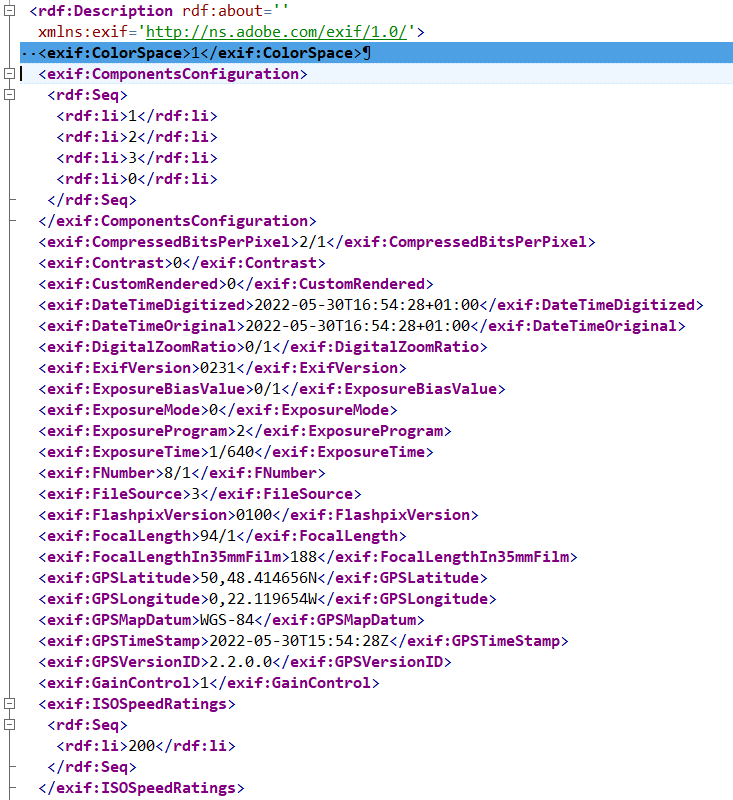
This is detectable by looking to see if the XMP tags are present. If they are, you added the metadata after, otherwise it came from the camera.
This sounds like either the database needs scrapping or that you need to manually read the metadata in.
Maybe, but I also tried to create a new database (renamed the old folder and created a new one) and there was no difference. And how can I manually read the metadata in?
ExifTool 
No, the issue also exists in DPL on Mac, but it depends on how GPS data got into the files.
I’ve loads of files with GPS coordinates that show in Lightroom, but not in DPL.
@Ralf_Brinkmann The problem I experienced at Win 10 PL5.1.4 "Corrupted" DOP plays havoc with PL5.3.1.4762 keywords (Probably finger trouble) is not this problem.
I played with GeoSetter during PL5 beta so tried to set the location of one of my flowers at the end of the pier, as you do! With PL5.3.1 (Win10) already running on my Main machine and showing the directory of flowers while I updated one with GeoSetter the image refreshed but did not update the geolocation!
Started Test machine, started PL5.1.4 and navigated to image and the geolocation was found immediately.
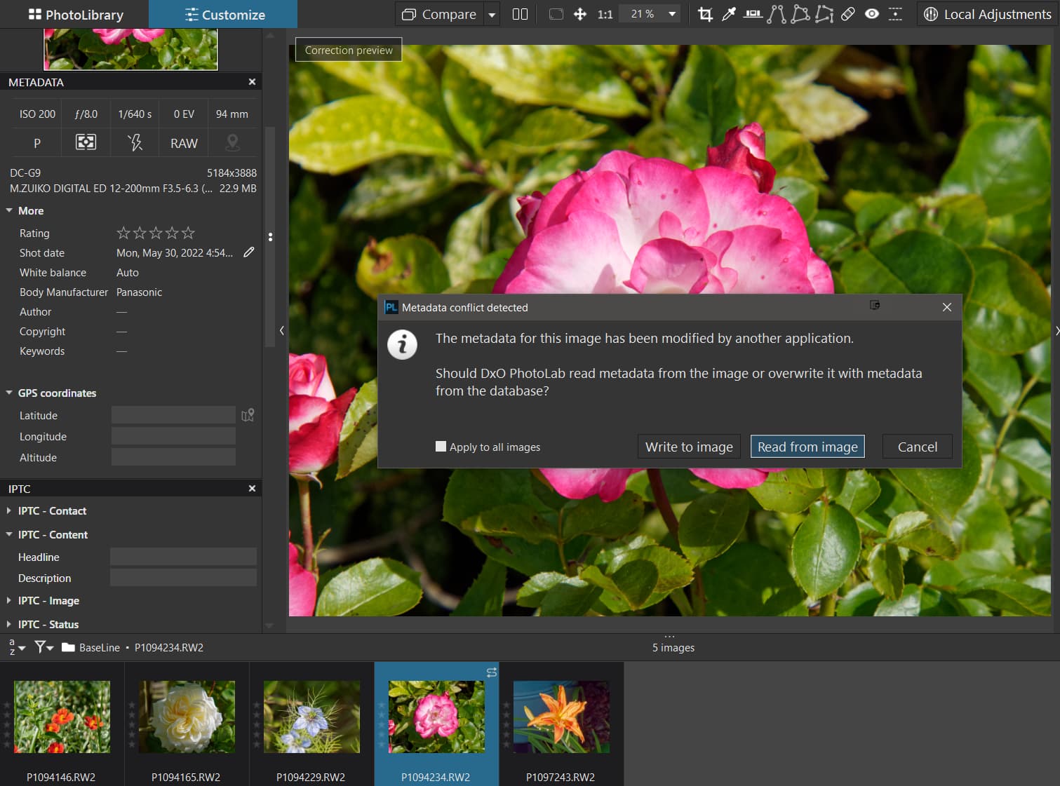
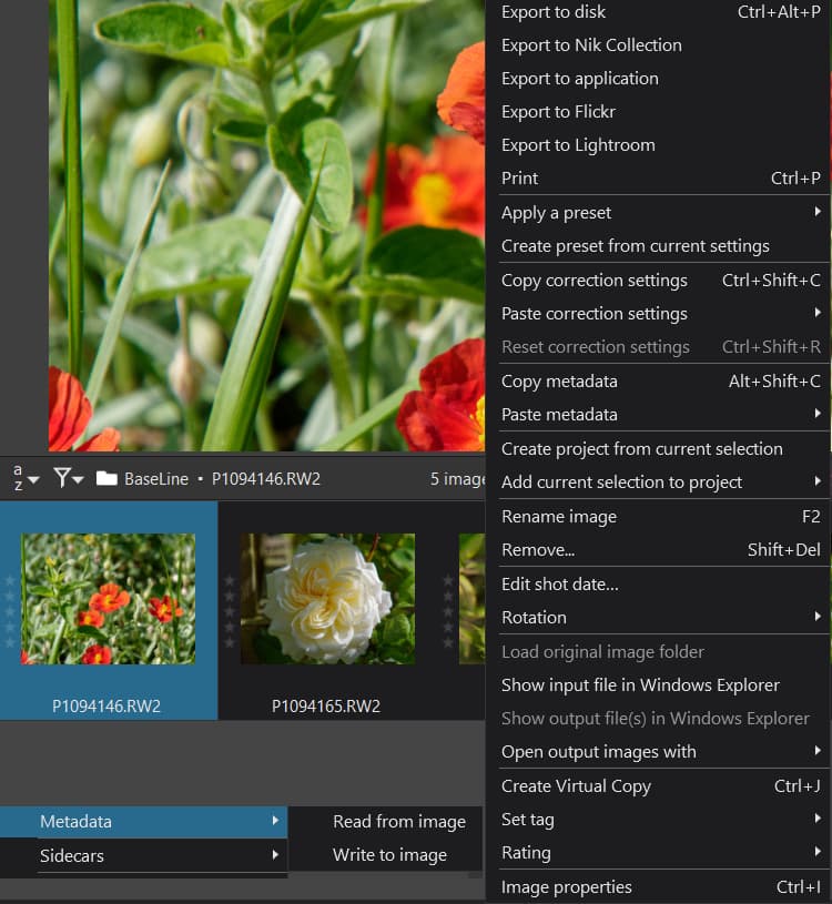
Tried a ‘File’/‘Metadata’/‘Read from Image’ on the Main machine (PL5.3.1) and the location was detected and refreshed.
Not a definitive test but might be worth a try with ‘Read from Image’ if you have not tried that already!
Please remember the very first lines of my Post about the changes when discovering new images with AS(OFF) Pre-PL5.3.0 the metadata will be taken from the image after PL5.3.0 it will be taken from the DOP. If you edit an image then a DOP will be created and any first discovery of that image will now take metadata from the DOP, if there actually is any.
Before trying anything else try the ‘Read from Image’ just in case.
Edit:-
Sorry I was rushing before lunch, repeated with another flower image
‘S’ icon set so ‘Read from Image’!
The GPS data in the sidecar
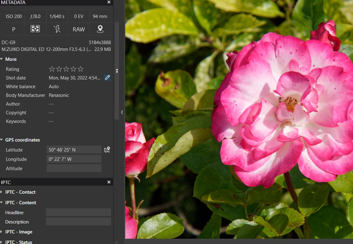
and now in PL5.3.1
@BHAYT, where is this “Read from image”? I don’t see it here. I thought that PL always reads from the images, if they contain metadata.
@Ralf_Brinkmann The answer to that is yes and no.
With AS(OFF) as I believe you were running and I am running for the tests the following happens!
On first discovery only:
Pre PL5.3.0 Read image and take metadata from image (and sidecar etc,)
Post PL5.3.0 Iff (if and only if) there is a DOP sidecar then take metadata (if any) from the DOP and do not take any from the image else take metadata from the image (and sidecar) as before.
On detection of any change (timestamp detection) then with AS(OFF) set ‘S’ icon else if AS(ON) automatically update Metadata!
The ‘Metadata’ command is always available here regardless of AS(OFF) or AS(ON)
I would like to learn this trick, how to read metadata I created with Exiftool to PL also with Exiftool.
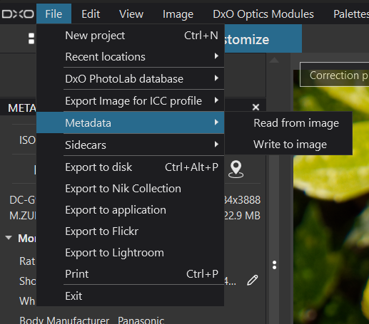
@BHAYT, I found it now!!! It’s hidden in the FILE menu:
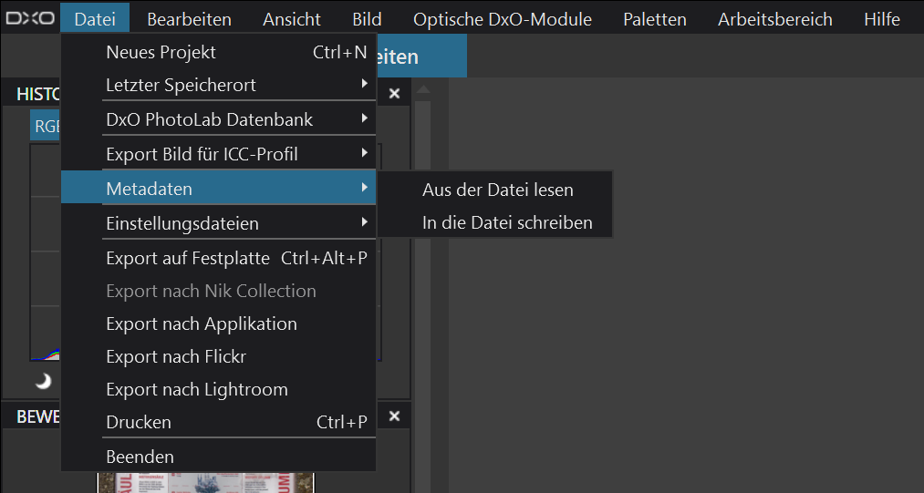
I was searching it in “Image” => “Metadata …”.
It works. I thought I had to type every single GPS location manually into the relating data fields.
But what do you mean with AS(ON) and AS(OFF)?
@Ralf_Brinkmann My shorthand for
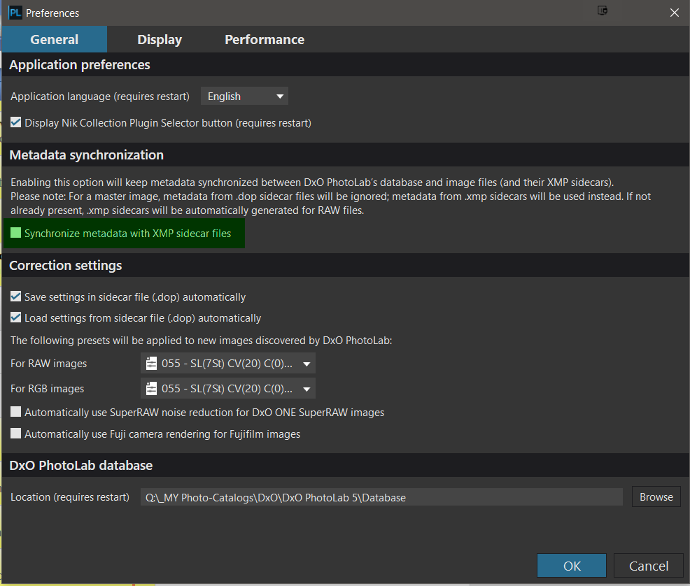
Leaving ‘Synchronize metadata with XMP sidecar’ = Blank = AS(OFF), setting that field = AS(ON)
Because it used to be shown as
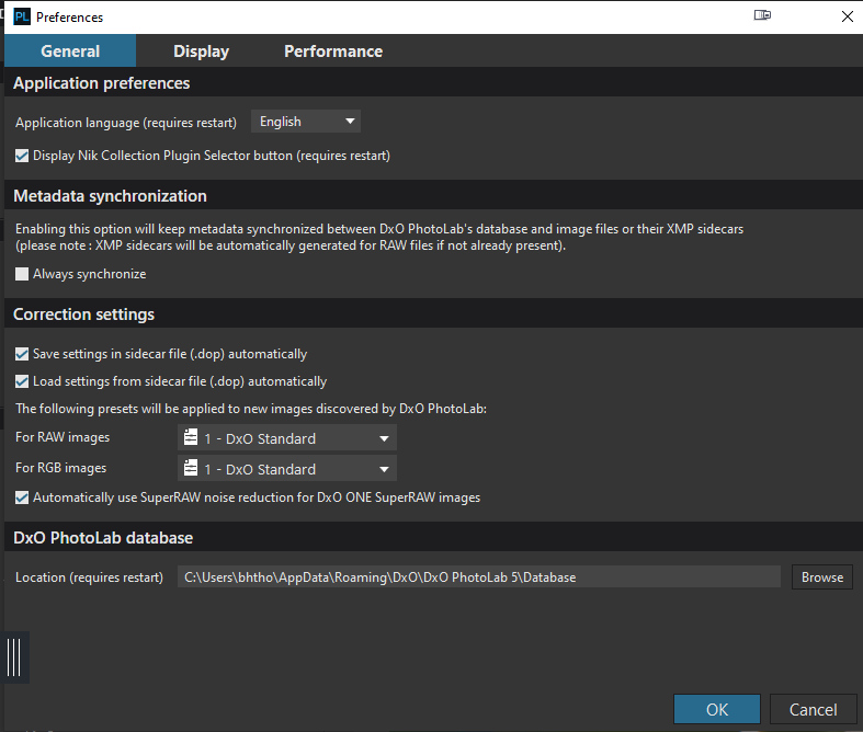
Ah, ok. I don’t use this *.xmp switch and leave it OFF because I only use PhotoLab and *.dop files, no Lightroom, Photoshop and so on.
If I can just add - setting the metadata to auto-sync has a nasty tendency to blitz your folders with XMP files as soon as you browse the folder and whether you have changed anything or not.
Since I write all my metadata directly to my RAW files, this is a right royal PITA (douleur royale dans le cul / eine echte Nervensäge) 
@Joanna, nothing is flooded with *.xmp files here because I don’t use them. And in earlier versions, the GPS metadata was ALWAYS automatically compared with the RAW file or this data was imported into PL. That should definitely be restored, I think with a switch that you can turn it on or off according to your own taste.
In the example test I documented I used GeoSetter and created an xmp sidecar files. What do your settings look like for GeoSetter and are you putting the GPS data into the RAW file?
That’s because you have turned off auto-sync for metadata.
The problem is, once PL has read the metadata from your files, it writes it to its database. This means, to save time and effort, PL goes to the database to read it back in again instead of going back to the file.
So, if you open a file without any GPS in PL, blank GPS data gets written to the database and, if you then add GPS outside of PL, PL will read “nothing” from the database, even though you have updated the file.
In order to make PL catch up with that change, you need to go to the File menu and force PL to re-read the metadata again.
@Joanna, but that’s new. As I wrote before, in older versions of PL I could have both programs open at the same time, PhotoLab and Geosetter/ExifTool and always after or while editing an image write the geolocation to the RAW file and it was updated at once in PL. That was never a problem for me.
But by the way: This discussion helped me a lot, because now I know how to get my GPS data from the RAW file into PL. I didn’t know there is a button for manually updating these informations in the database.
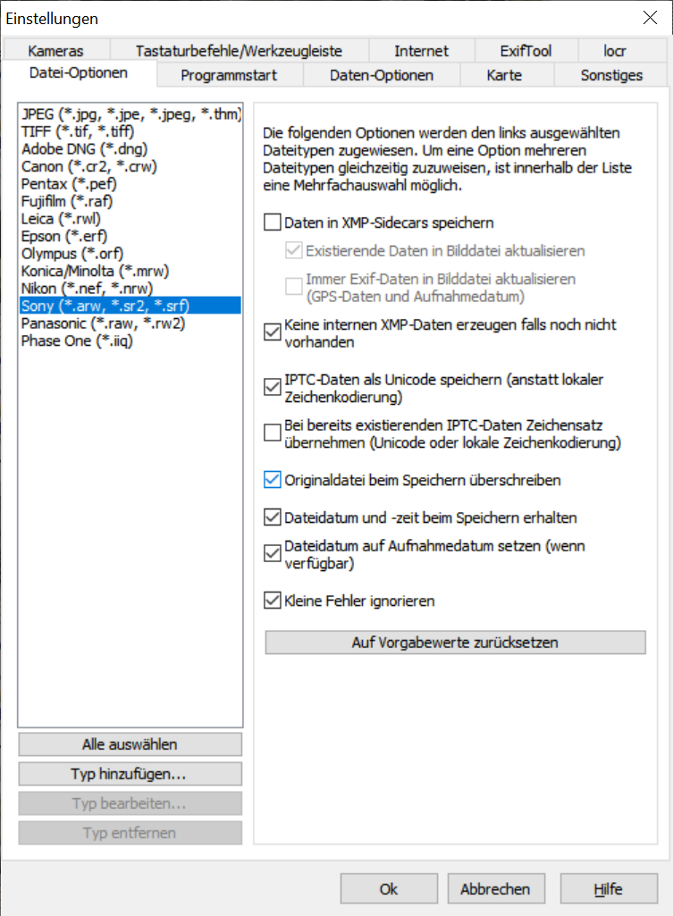
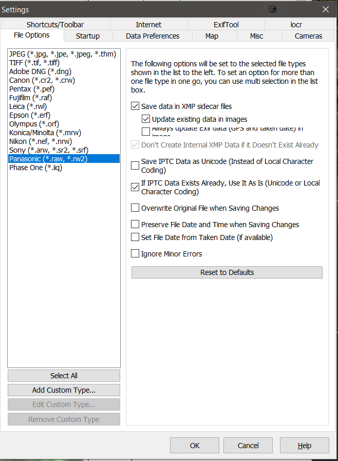
I write the GPS data and all IPTC data into the RAW file. These are my settings:
A shortcut for “Read [metadata] from image” would be nice.
Edit:- Sorry ! I misunderstood that you were asking for a a 'Ctrl+ … etc.) command. I have been asking for the command(s) to be added to the Thumbnail right click menu and adding a shortcut would also be useful @sgospodarenko
but I must admit the menu is already on the big side!
It’s the same command, PL5 is smart enough to take data from both the xmp sidecar and the image automatically with AS(ON), manually with AS(OFF), with xmp sidecar data taking precedence over embedded metadata (I believe).
Hence, the nearest equivalent to the old way PL4 way of working is AS(ON) but that is a “two way street” now. With PL4 the DxO immutability “constraints” meant that no metadata was written to anything other than the database and the DOP (only the ‘Rating’ and ‘Rotation’ to the DOP) I believe.
Hence, the loss of the database meant that a lot of metadata entered directly into PL4 would be lost (except for any exports), but all that entered from the image would still be intact in the image (by image I mean JPG, TIFF, DNG and RAW file and/or in an xmp sidecar file accompanying a RAW file).
To re-iterate, up to PL5.3.0 the initial discovery of a “new” (to the database) image would cause the metadata to be read from the xmp sidecar file and/or a RAW file automatically or directly from JPG, TIFF and DNG.
Thereafter AS(ON/OFF) would control the automatic metadata updating or the need for manual reading of the metadata from the image (JPG, TIFF, DNG & RAW plus an xmp sidecar file for a RAW if it existed). Please note that PL5 embeds all metadata updates for all image types EXCEPT RAW, where an existing xmp sidecar will be used or a new xmp sidecar will be created, to store new or updated values of metadata fields.
From PL5.3.0 the AS(OFF) now signals a change in the action taken on a new discovery and PL5 has “reverted” to the PL4 action and takes metadata from the DOP.
I believe that with PL4 because of the restricted amount of metadata held in the DOP all the rest of the metadata was still obtained from the image!
However, with the greatly increased amount of metadata that PL5 is now handling a PL5 DOP is effectively a “road-block” for any metadata from the image, i.e. I believe that no metadata is ever taken from the image if there is a PL5 DOP at the time of first discovery with AS(OFF) @sgospodarenko can you please verify this with the developers, my tests seem to indicate this to be true but I have not tested every metadata field and have not tested GPS in particular.
@sgospodarenko understanding this is critical to any and all advice that we might try to impart to other users and testing it exhaustively is just that, time consuming and exhausting!
I hope that things are falling into place and thanks for the GeoSetter update so my settings were
Morning,
- Yes, at least for the images provided by Ralf it’s true, on MAC the GPS is displayed.
- No need, I tested via the previous version and GPS is not displayed either.
- Yep, for your images GPS is not displayed both Mac and Win.
Regards,
Svetlana G.